
By Alex Comstock
This past year I started using a new tool for hunting, and it's been something that's been game changing for me. OnX maps has literally changed the way I scout, look at maps, identify public and private land, and ultimately hunt. OnX is something I'd strongly recommend to anybody, whether you hunt public land, or own your own property, and here's why.
The Basics: At the most basic level, OnX allows you to identify public lands, and private parcels. You can buy OnX, which is not only a mobile app for your phone, but it doubles as a website you can access on your computer. Any information logged in the app is automatically transferred to the online version, and vice versa. You can purchase OnX on a state by state basis for a yearly fee, or purchase a nationwide subscription as well. The map gives you three viewing options, as you can view in satellite mode, topographic mode, or a hybrid, showing you both versions overlayed. When clicking on a parcel of property, you automatically get who owns the property, the tax address, city, and state, and how many acres it is. Much of the time when I'm out driving in the spring for scouting, or during summer nights looking for velvet bucks, I'll have the app open, and if I see something I like, I can instantly see who owns the property.
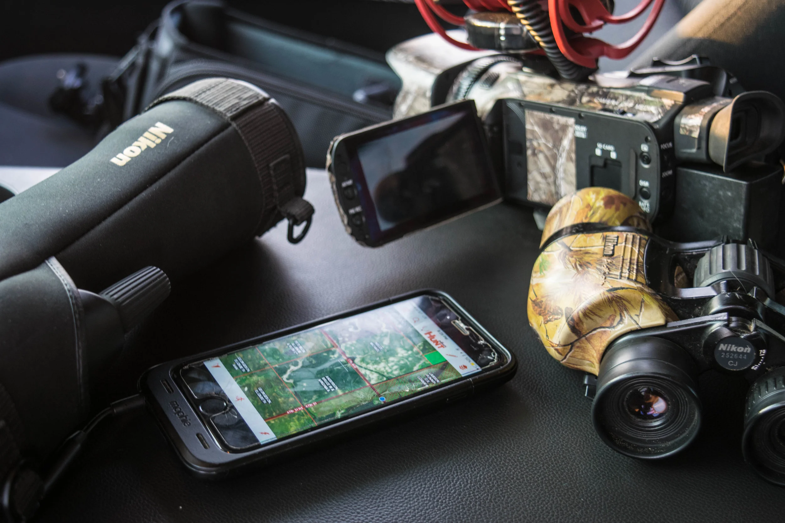
OnX maps has become a scouting staple.
Map Tools: Other than just being a tool for identifying property, OnX serves as a great asset for current hunting properties, and throughout the deer season. You have the ability to mark waypoints as everything from treestands to ground blinds, and trail cameras. If a buddy has the app too, you can even share wapoints with them. You also can measure the area of any shape you want. If you want to measure the area of a field, food plot, or section of timber, with just a few clicks you can figure out how many acres something is. Additionally, you can measure straight line distances. Whether you're trying to figure out how far of a walk it is to your treestand, or how far away two bedding areas are from each other, I really like this function. Lastly, you have the ability to turn on the tracker. This can be particularly useful if you want to track your route in to a treestand to help get in and out better, or if you want to keep track of where you've shed hunted. What I really like is you can save and delete tracks whenever you want.
Map Layers: Honestly, there's a lot of features in OnX that I haven't even dug into yet, but when it comes to your map layers, there are a lot of really cool features. Each state has a bundle of layers that you can turn on and off at anytime. This include private lands, public lands, and different types of public lands. For instance, in North Dakota, there's what you call PLOT lands which stands for Private Land Open to Sportsman. I can turn the "ND Plots" layer on and off, depending on if I'm looking for PLOT'S land or not.

Each state has a bundle of layers that you can turn on and off at anytime.
There are also some really neat nationwide layers you can turn on and off as well. Just to name a few, you have to option to view layers such as a precipitation radar, roadless areas, timber cuts, historic wildfires, current wildfires, recreation sites, public trails, and much more. You could spend a lot of time playing with these layers, and getting to intimately know property.

There are many nationwide layers you can dive deep into.

One of the most fascinating layers to me is the roadless layer.
Do You Need Service?: One of the first questions I always get when I'm talking about OnX is do you need cell service to use it in the field? Technically you don't. Although you do need service to operate the app in the field if you're in an area you've never been to or looked at from the couch, you do have the ability to not need service. You have the option to save maps. For instance, one of my prime spots in North Dakota, I know I get zero service. Therefore, I highlighted the area of the map I wanted to save, and once you save your map, you can go "offline" when you're there, and you don't need service for the map to track your location or to use the app at all. This is one of my favorite functions as there is nothing worse than having an awesome mapping app, but needing service to use it, and hunting in an area with no service.
Overall Thoughts: Obviously, I am a fan of OnX maps. I think it's a valuable tool, and it truly has made a difference in how I hunt. It's helped me the most in identifying small pieces of public land that I never knew existed. I just turn on the public land layer for the state I'm looking in, zoom out a bit, and start scanning. If you are looking for something to help your hunting efforts this year, consider giving this a look.
To see more, visit OnXmaps.com